 Inicio
Servicio Web de Mapas de Patrimonio Cultural. IDE de Extremadura
Servicio Web de Mapas de Patrimonio Cultural
Simple
Información de Identificación
- Fecha (Creación)
- 2017-04-07
- Propósito
-
Patrimonio Cultural
- Crédito
-
Junta de Extremadura.
-
Nomenclature of Territorial Units for Statistics (NUTS)
-
-
ES43 (España - Extremadura)
-
-
ISO3166
-
-
ESPAÑA
-
SPAIN
-
-
INSPIRE_SpatialDataServicesClassification
-
-
Servicio de gestión de modelos, información geográficos
-
infoMapAccessService
-
Servicio de gestión de modelos/información geográficos
-
infoManagementService
-
-
ISO 19119 geographic services taxonomy, version 2.3
-
-
Map access service (infoMapAccessService)
-
Geographic model information management service (infoManagementService)
-
-
INSPIRE_SpatialThemes
-
-
WMS
-
Servidor de Mapas en Red
-
Infraestructuras de Datos Espaciales
-
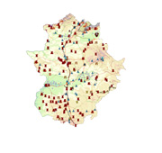
Patrimonio
-
Cultural
-
I 09 Catedrales
-
I 09 Diócesis
-
I 09 Castillos
-
I 09 Patrimonio de la Humanida
-
I 04 Pueblos de colonización
-
-
WebServicesSpecification
-
-
1.3.0
-
WMS
-
OGC
-
-
IAAASpanishScopeThesaurus
-
-
3.REGIONAL
-
EXTREMADURA
-
ex
-
-
ISO - 19119 geographic services taxonomy
-
-
infoCatalogueService
-
- Uso específico
-
Todo tipo de usuarios (empresas, administraciones, etc). Para todo tipo de aplicaciones y sobre todo tipo de plataformas.
- Limitación de uso
- Restricciones de Acceso
- Otras restricciones
- Otras limitaciones
- Tipo de Servicio
- view
- Versión del Servicio
-
OGC:WMS
))
- Tipo de acoplamiento
- Suelto
Contiene operaciones
- Nombre de la operación
-
GetCapabilities
- Plataformas de computación distribuída
- Servicios web
- Punto de connexión
- http://www.ideextremadura.com/CICTEX/patrimonioCultural
Contiene operaciones
- Nombre de la operación
-
GetMap
- Plataformas de computación distribuída
- Servicios web
- Punto de connexión
- http://www.ideextremadura.com/CICTEX/patrimonioCultural
- Formato de la distribución
-
-
PNG
(
Compatible para su visualización a través de un WMS 1.3.0
)
-
JPEG
(
Compatible para su visualización a través de un WMS 1.3.0
)
-
PNG
(
Compatible para su visualización a través de un WMS 1.3.0
)
- Jerarquía
- Servicio
- Otros
-
Servicio web de datos espaciales. Servicio de visualización
Conformidad del Resultado
- Fecha (Publicación)
- 2009-10-19
- Explicación
-
Consultar el reglamento mencionado
- Aprobado
- Sí
Conformidad del Resultado
- Fecha (Publicación)
- 2010-12-08
- Explicación
-
Consultar el reglamento mencionado
- Aprobado
- No
Conformidad del Resultado
- Fecha (Publicación)
- 2008-12-04
- Explicación
-
Consultar el reglamento mencionado
- Aprobado
- Sí
- Identificador del fichero
- spaJEXWMSPatrimonioCultural XML
- Idioma del metadato
- Spanish; Castilian
- Jerarquía
- Servicio
- Nombre del nivel de jerarquía
-
Servicio
- Fecha
- 2024-05-24T11:25:18
- Nombre estándar del metadato
-
NEM-S: ISO 19115:2003 / ISO 19119 + Reglamento (CE) Nº 1205/2008 de Inspire